Services
Monitoring Solutions
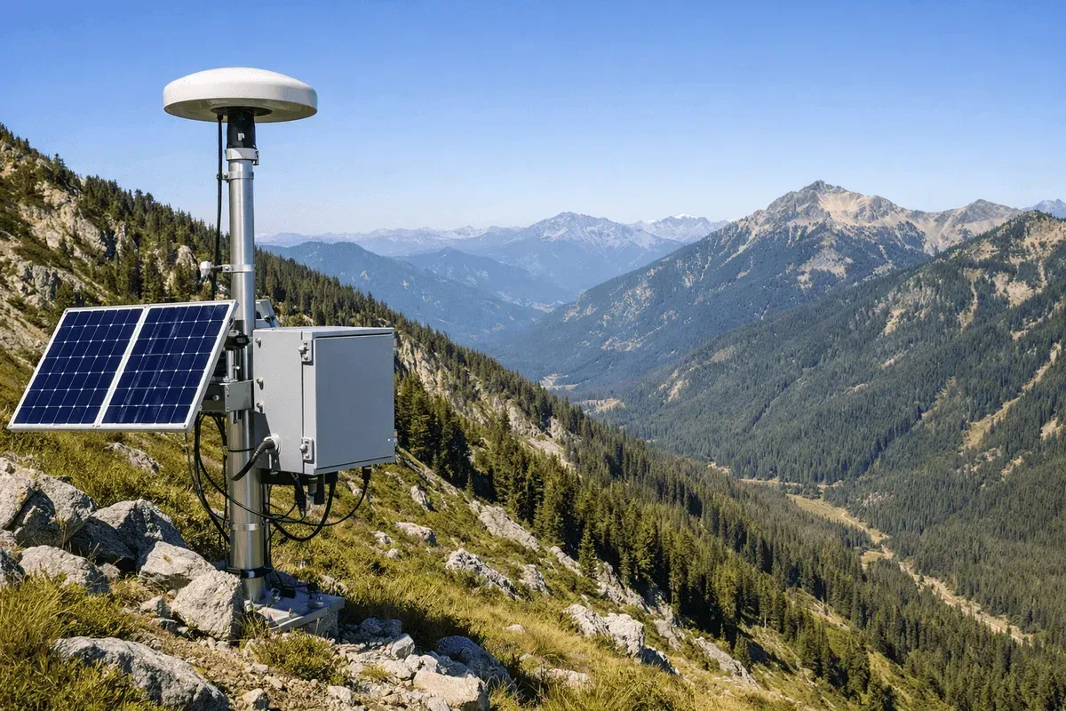
Real-Time Slope Monitoring
A real-time slope monitoring solution integrating RTK GNSS, inclinometers, accelerometers, and AI early warning, providing 24-hour continuous monitoring and tiered alerts for road slopes, mountain settlements, engineering excavations, and landslide-prone areas.
Landslide-Prone Area Monitoring
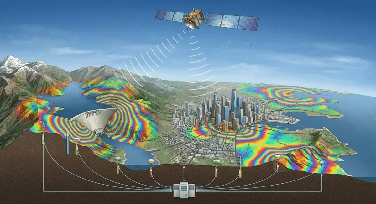
Large-scale collapse and landslide-prone area monitoring integrating InSAR satellite radar, GNSS, and IoT corner reflectors, providing wide-area deformation surveys, prone-area identification, and long-term tracking to support disaster mitigation management and decision-making.
Land Subsidence & Urban Settlement Monitoring
Large-area land subsidence and urban settlement monitoring using InSAR (PS-InSAR / SBAS-InSAR), with millimeter-level measurement, the ability to retrieve historical trends, and the capacity to target specific buildings, roads, levees, and pipeline corridors.
InSAR Satellite Radar Deformation Analysis
Three complementary satellite radar interferometry deformation analysis techniques—DInSAR, PS-InSAR, and SBAS-InSAR—offering millimeter-level detection, coverage of hundreds of square kilometers, no need for on-site equipment, and the ability to retrieve historical imagery for long-term deformation analysis.
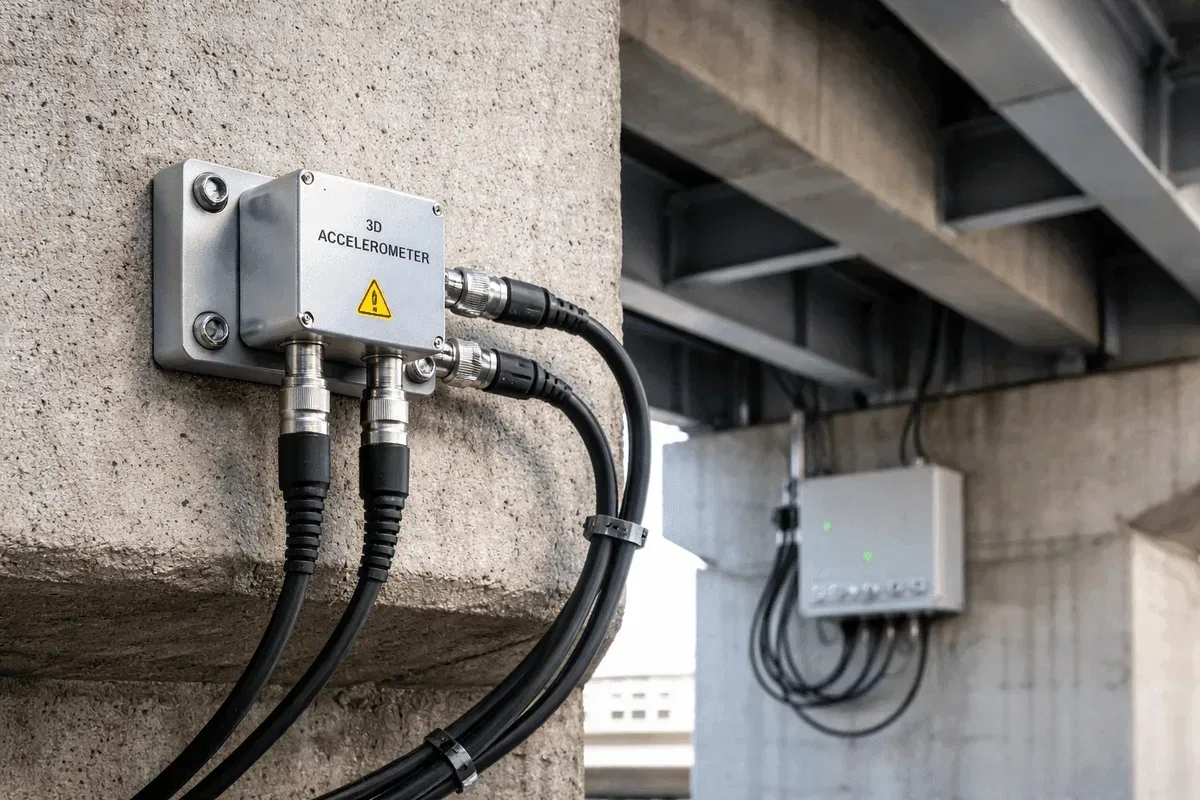
Bridge Structural Health Monitoring
Bridge structural health monitoring integrating GNSS and accelerometers, providing 24-hour continuous tracking of pier and deck displacement, dynamic vibration, and natural frequency changes to support early detection of structural deterioration and scour risk.
Dam & Reservoir Deformation Monitoring
Dam and reservoir deformation monitoring combining GNSS and InSAR, continuously tracking 3D displacement of the dam body and surrounding slope deformation, with the ability to overlay environmental factors such as water level to interpret the effects of impounding and releasing water.
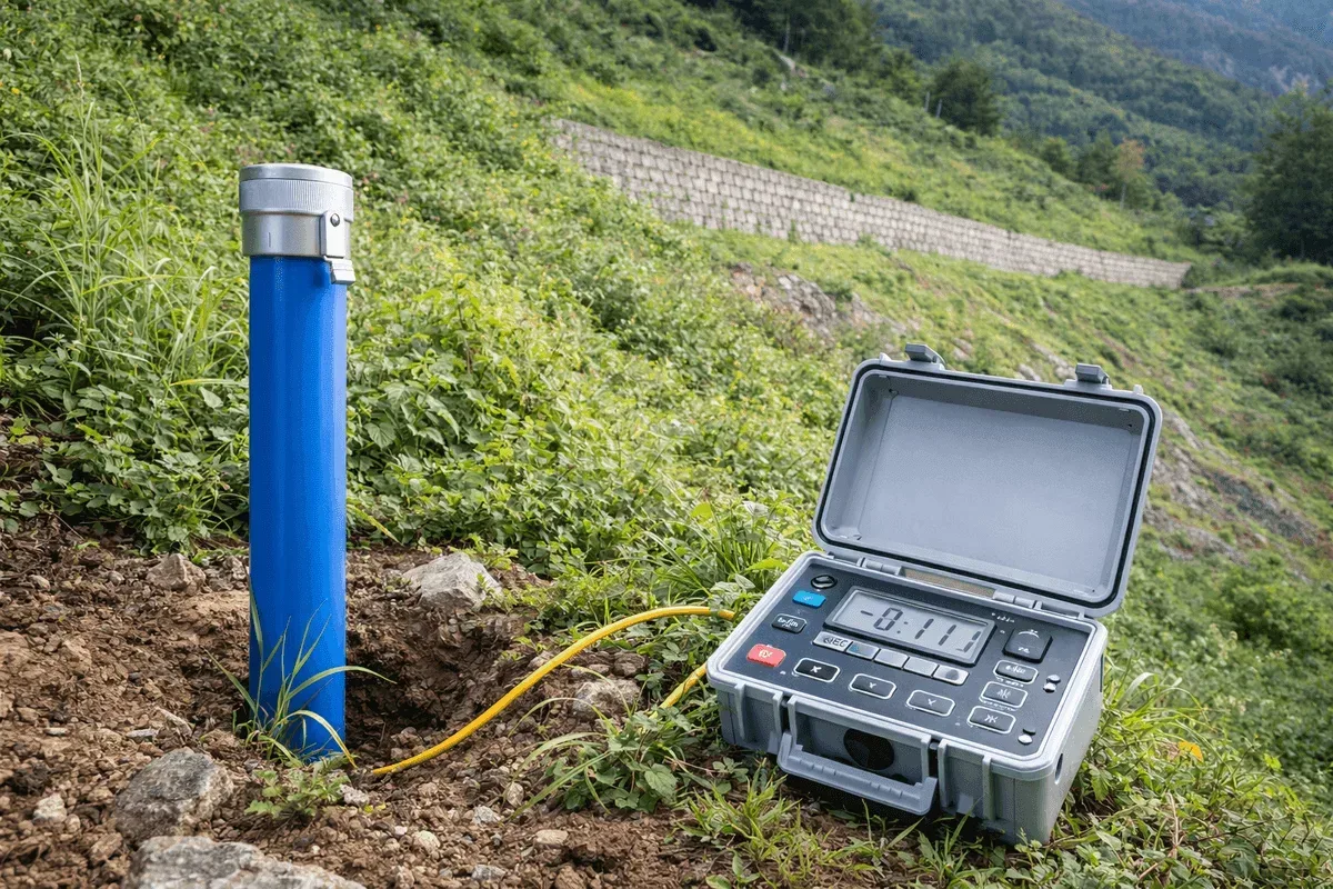
Retaining Wall & Slope Structure Monitoring
Retaining wall and slope structure monitoring using inclinometers and GNSS to track wall tilt, deep-layer horizontal displacement, and 3D displacement of the wall top, suitable for deep excavation support and stability assessment of retaining structures.

Real-Time Landslide Early Warning System
A real-time landslide early warning system integrating on-site sensors and AI recognition models, analyzing displacement and environmental data in real time on the GeoGuard platform, automatically issuing tiered alerts and linking to government alert sources.
3D Terrain Modeling & Mapping
3D terrain modeling and mapping integrating UAV aerial photography and LiDAR, producing high-density point clouds, Digital Elevation Models (DEM), Digital Surface Models (DSM), and orthophotos, suitable for engineering surveys, earthwork calculations, and digital terrain for land consolidation areas.
Forestry Survey & Forest Resource Mapping
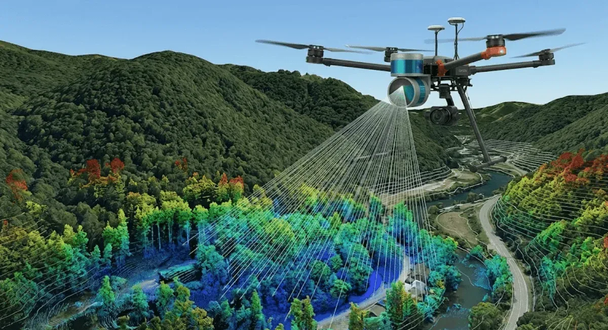
Forestry survey and forest resource mapping using UAV LiDAR, with laser penetrating the canopy to obtain understory terrain, tree height, and canopy structure, supporting forestry conservation, watershed management, and carbon sink estimation.
Main Services
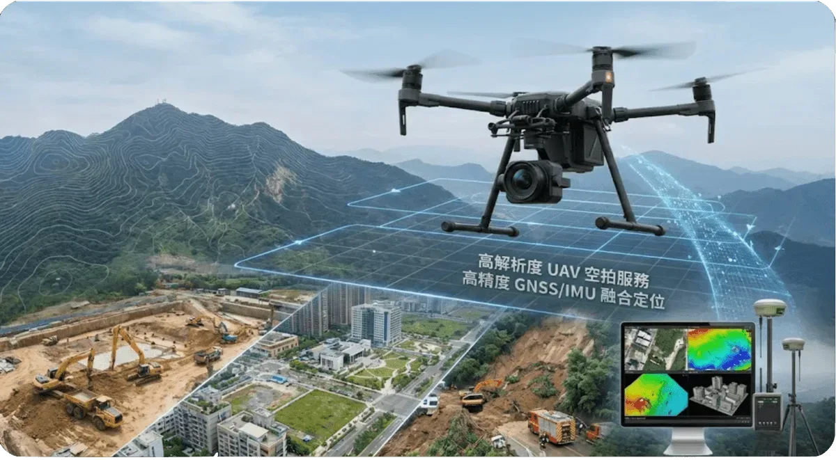
UAV Aerial Services
High-precision aerial photography and photogrammetry using drones for terrain modeling, engineering monitoring, and environmental surveys.
UAV LiDAR Scanning Services
Using LiDAR technology for 3D spatial scanning to provide high-precision terrain and structure measurement — for 3D terrain modeling, forestry survey, and mining earthwork measurement.
InSAR Deformation Monitoring
Satellite radar interferometry services covering DInSAR, PS-InSAR, and SBAS-InSAR for large-scale ground deformation monitoring — land subsidence, urban subsidence, and large-scale landslide deformation.
Equipment Maintenance
Providing professional monitoring equipment installation, calibration, maintenance, and technical support services.
Geotechnical Monitoring Systems
GNSS Positioning
Real-time kinematic positioning system providing centimeter-level displacement monitoring — for real-time slope monitoring, bridge displacement, and dam deformation, 24/7.
Accelerometer Monitoring
High-precision accelerometer monitoring system for structural dynamic response analysis and early warning.
Inclinometer Monitoring
Precision tilt angle monitoring for slopes, retaining walls, structural tilt, and deep horizontal displacement monitoring.
AI Prediction System
Combining artificial intelligence and machine learning to provide disaster warning and trend prediction services.
GeoGuard Data Platform
An intelligent data platform built for geotechnical and engineering monitoring, integrating sensor data, anomaly detection, AI analysis, and government alerts.
Frequently Asked Questions
What regions does RST Ltd. serve?
We primarily serve all of Taiwan, covering various engineering monitoring and geospatial information applications. For special requirements or international projects, please contact us and we will assess feasibility based on the project nature.
How can I get a service quotation from RST Ltd.?
Please contact us through the website contact form or call +886-4-26319908. Provide a project overview and requirements description, and our engineering team will respond promptly with a detailed service proposal and quotation.
What types of services does RST Ltd. provide?
We provide comprehensive monitoring and geospatial information services, including UAV aerial survey, LiDAR scanning, 3D modeling, InSAR satellite radar deformation monitoring (DInSAR / PS-InSAR / SBAS-InSAR), GNSS positioning, accelerometer and inclinometer monitoring, AI intelligent prediction, GeoGuard data platform, and equipment maintenance services.