UAV LiDAR Scanning Services
Services
Service Content
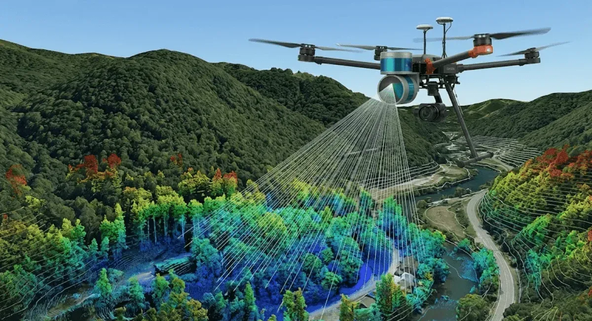
Adopting advanced LiDAR (Light Detection and Ranging) technology, we provide high-precision 3D spatial measurement services, suitable for rapid scanning of complex terrain and large-scale areas.
Main Applications
- Terrain measurement and Digital Terrain Model (DTM) creation
- Forestry resource survey
- River and hydraulic facility measurement
- Building and infrastructure scanning
Technical Advantages
- High-density point cloud data
- Strong vegetation penetration capability
- Not limited by lighting conditions
- Large-scale rapid measurement
Frequently Asked Questions
What accuracy can UAV LiDAR scanning achieve?
Our UAV LiDAR system scans at 240,000 points per second with 2 cm accuracy. Combined with GNSS/IMU trajectory data for precise positioning, it produces high-quality Digital Elevation Models (DEM) and Digital Surface Models (DSM).
What is the difference between LiDAR scanning and traditional aerial photography?
LiDAR uses laser to penetrate vegetation and capture true ground elevation, making it ideal for terrain measurement in vegetated areas. Traditional aerial photography uses image-based modeling, better suited for bare surfaces. The two methods complement each other, and we also provide colored point cloud fusion services.
What deliverables are included in LiDAR scanning services?
Standard deliverables include high-density 3D point cloud data, DEM, DSM, and colored point clouds. Depending on project requirements, advanced analysis such as contour maps, cross-section profiles, and volume calculations can also be provided.