Dam & Reservoir Deformation Monitoring
Services
Service Overview
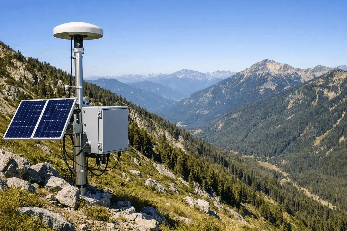
RST Ltd. provides dam and reservoir deformation monitoring services, using GNSS to continuously monitor the 3D displacement of key points on the dam body, and InSAR to capture surface deformation across the dam area and surrounding slopes over a wide area. Combining the two allows simultaneous observation of dam body displacement and the stability of areas around the reservoir.
Applicable Scenarios
- Displacement of concrete dams, earth-and-rockfill dams, and levee dam bodies
- Stability of slopes around the reservoir and the impounded area
- Observation of dam body behavior during impounding and releasing of water
- Long-term deformation tracking of aging reservoirs
Monitoring Methods
- Technologies used: GNSS for 3D displacement of the dam body, InSAR deformation analysis for deformation of the reservoir area and surrounding slopes
- Measurement items: 3D dam body displacement, surface deformation rate in the reservoir area, with the option to overlay environmental factors such as water level
- Accuracy specifications: GNSS horizontal 1–2 cm, vertical 2–3 cm; InSAR millimeter-level relative deformation
- Data transmission and visualization: Data is integrated into the GeoGuard platform, with overlay analysis of environmental factors and deformation
Comparison with Other Methods
| Item | GNSS (dam body) | InSAR (surroundings) | Manual measurement |
|---|---|---|---|
| Timeliness | 24-hour continuous | Per satellite cycle | Periodic |
| Coverage | Key dam body | Wide reservoir area | Key points |
| Environmental factor integration | Yes | Yes | Limited |
| Best for | Dam body displacement | Surrounding slopes | Supplementary checks |
Representative Cases
Our services cover numerous reservoir and dam deformation monitoring projects.
Service Process
- Site assessment — confirm monitoring priorities for the dam body and reservoir area
- Equipment and data — deploy GNSS and acquire InSAR imagery
- Continuous monitoring — data integrated into the GeoGuard platform for analysis
- Reporting and early warning — deformation trends, interpretation of impounding/releasing effects, and alerts
Get in Touch
Need dam or reservoir deformation monitoring? Feel free to contact us.
Frequently Asked Questions
How does dam deformation monitoring address both the dam body and its surroundings?
We use GNSS to continuously monitor the 3D displacement of key points on the dam body, and InSAR to capture surface deformation across the dam area and surrounding slopes over a wide area. Combining the two allows simultaneous observation of dam body displacement and the stability of areas around the reservoir.
Can monitoring continue during reservoir impounding and water release?
Yes. GNSS provides 24-hour continuous monitoring, unaffected by weather or impounding/releasing of water; paired with the GeoGuard platform, environmental factors such as water level can be overlaid with deformation data to help interpret the effect of impounding and releasing water on the dam body.
What accuracy can be achieved?
GNSS continuous monitoring can reach 1–2 cm horizontally and 2–3 cm vertically, and InSAR can achieve millimeter-level relative deformation detection on stable reflectors. Actual accuracy depends on site conditions and the number of data acquisitions.