Landslide-Prone Area Monitoring
Services
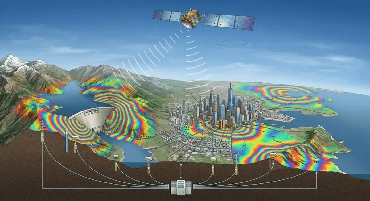
Service Overview
RST Ltd. provides landslide-prone area monitoring services, using InSAR satellite radar for wide-area deformation surveys to pinpoint active prone areas, followed by long-term tracking with GNSS and IoT corner reflectors—balancing wide-area coverage with focused accuracy. Our clients include agencies such as the Agency of Rural Development and Soil and Water Conservation, the Forestry and Nature Conservation Agency, and the Geological Survey and Mining Management Agency.
Applicable Scenarios
- Large-scale collapse-prone areas and slopes above protected assets
- Watersheds, protection forests, and compartment slopes
- Collapse-prone zones around mountain roads and settlements
- Continuous deformation tracking in post-disaster reconstruction areas
Monitoring Methods
- Technologies used: InSAR satellite radar deformation analysis (DInSAR / PS-InSAR / SBAS-InSAR), GNSS, and IoT corner reflectors
- Measurement items: wide-area surface deformation rates and trends, 3D displacement at key locations
- Accuracy specifications: InSAR can achieve millimeter-level relative deformation detection on stable reflectors; GNSS at centimeter level
- Data transmission and visualization: Results are integrated into the GeoGuard platform, producing deformation rate maps and hotspot maps
Comparison with Other Methods
| Item | InSAR wide-area survey | GNSS / corner reflectors | Manual inspection |
|---|---|---|---|
| Coverage | Hundreds of square kilometers | Key locations | Limited |
| Historical retrospection | Can retrieve historical imagery | From station setup onward | None |
| Timeliness | Per satellite cycle | 24-hour continuous | Periodic |
| Best for | Screening prone areas | Focused tracking | Supplementary verification |
In vegetated areas, SBAS-InSAR is used together with artificial corner reflectors (CR) to establish stable reflection points and improve reliability.
Representative Cases
Our services cover numerous government-commissioned large-scale collapse and prone-area deformation monitoring projects.
Service Process
- Wide-area survey — InSAR deformation analysis to identify active prone areas
- Focused deployment — installation of GNSS and corner reflectors at key locations
- Long-term tracking — data integrated into the GeoGuard platform for continuous analysis
- Management and early warning — providing deformation trends, hotspot maps, and disaster mitigation recommendations
Get in Touch
Need a wide-area inventory of prone-area deformation? Feel free to contact us.
Frequently Asked Questions
How are large landslide-prone areas monitored?
We use InSAR satellite radar to perform wide-area deformation surveys; after pinpointing active prone areas, we deploy GNSS and IoT corner reflectors at key locations for long-term tracking, balancing wide-area coverage with focused accuracy.
Can InSAR be used in densely vegetated mountainous areas?
Yes. Decorrelation is more severe in vegetated areas, so we use SBAS-InSAR small-baseline multi-pair processing to reduce its effects, and when necessary pair it with artificial corner reflectors (CR) to establish stable reflection points, improving monitoring reliability in vegetated areas.
Can the monitoring results be used for disaster prevention decision-making?
Yes. We integrate InSAR, GNSS, and environmental factors into the GeoGuard platform, providing deformation rates, trends, and hotspot maps to help authorities with the management, early warning, and response decisions for large-scale collapse disaster mitigation.