Land Subsidence & Urban Settlement Monitoring
Services
Service Overview
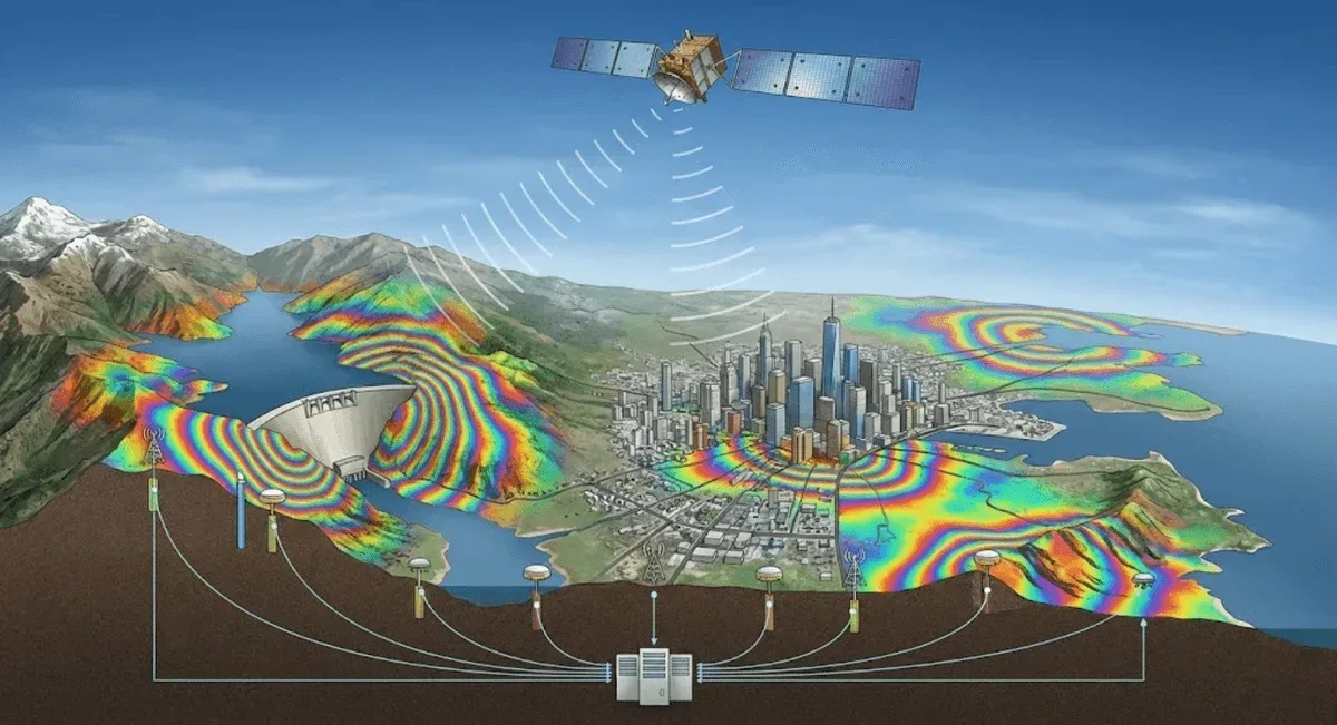
RST Ltd. provides land subsidence and urban settlement monitoring services, using InSAR satellite radar to perform millimeter-level subsidence measurement over areas of hundreds of square kilometers without installing any on-site equipment, and to analyze long-term trends by retrieving historical imagery. Our clients include agencies such as the Geological Survey and Mining Management Agency and local governments.
Applicable Scenarios
- Regional land subsidence inventory (agricultural and aquaculture areas)
- Urban settlement and differential settlement monitoring
- Settlement tracking of levees, roads, and bridge foundations
- Monitoring along linear facilities such as metro lines and pipelines
Monitoring Methods
- Technologies used: InSAR deformation analysis — PS-InSAR (point-by-point time series over stable reflectors), SBAS-InSAR (areas with changing surface cover)
- Measurement items: subsidence rate, cumulative subsidence, differential settlement
- Accuracy specifications: millimeter-level relative deformation detection on stable reflectors (depending on the number of data acquisitions and surface conditions)
- Data transmission and visualization: Results are presented as GIS layers and time-series curves, and can be integrated into existing geographic information systems
Comparison with Other Methods
| Item | InSAR | Leveling survey | Continuous GNSS |
|---|---|---|---|
| Coverage | Wide area, point by point | Along survey lines | Single point |
| Historical retrospection | Yes | Depends on existing data | From station setup onward |
| On-site equipment | Not required | Fieldwork required | Station setup required |
| Best for | Wide-area inventory | High-accuracy verification | Real-time continuous |
In practice, InSAR is used for wide-area inventory, followed by leveling or GNSS for on-site verification.
Representative Cases
Our services cover numerous regional land subsidence and urban settlement monitoring projects.
Service Process
- Scope definition — confirm the monitoring area and existing data
- Image analysis — PS / SBAS-InSAR processing and quality control
- Deliverables — subsidence rate maps, time-series curves, and differential settlement analysis
- Verification and integration — cross-checking with leveling / GNSS and integrating into GIS
Get in Touch
Need a land subsidence or urban settlement inventory? Feel free to contact us.
Frequently Asked Questions
Why is InSAR well-suited to land subsidence monitoring?
InSAR can perform millimeter-level subsidence measurement over areas of hundreds of square kilometers without installing on-site equipment, and can analyze long-term trends by retrieving historical imagery, making it especially suitable for wide-area land subsidence and urban settlement inventory.
What is the difference between PS-InSAR and SBAS-InSAR in subsidence monitoring?
PS-InSAR provides point-by-point long-term time series over stable reflectors such as buildings and roads, suitable for urban areas; SBAS-InSAR uses small-baseline processing to improve results in areas with changing surface cover, suitable for farmland, aquaculture areas, and the like. We often use both together to cover different surface types.
Can monitoring target specific buildings or pipelines?
Yes. Through point-by-point PS-InSAR analysis, subsidence rates and differential settlement can be extracted for specific buildings, roads, levees, or along pipeline corridors, with leveling or GNSS used for on-site verification when necessary.